8.6 km
Distance
3h 30min
Duration
+360 m
Elevation gain
Easy
Difficulty
June–October
Season
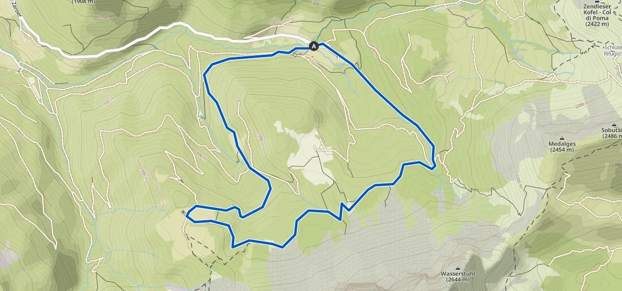
An almost level path running below the walls of the Furchetta and Sass Rigais, inside the Puez-Odle Nature Park. It reaches the Geisler Alm, the best place from which to see the Odle. Suitable for children too.
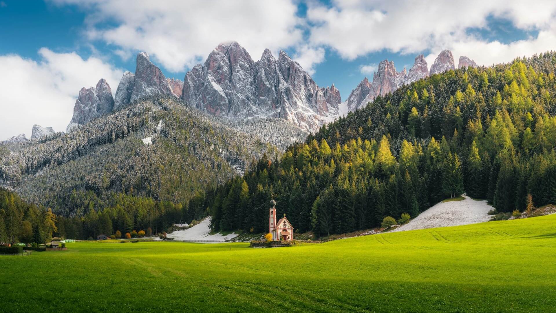
Val di Funes is one of the most sheltered valleys in South Tyrol: a handful of villages, farmsteads scattered across the slopes and, above everything, the wall of the Odle. The Adolf Munkel Weg is the most direct way to stand beneath them without facing a demanding climb. The path contours through the forest, with the Furchetta and Sass Rigais alongside from start to finish.
Highlights
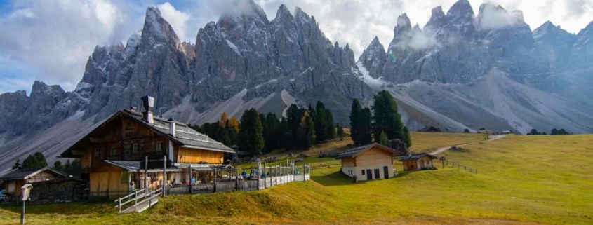
The Odle 'cinema'
The nickname comes from the way the place is laid out: in front of the Geisler Alm a row of wooden deckchairs faces the rock wall as though it were a screen. It is where almost everyone lingers longest, and it is worth doing.
The Puez-Odle Nature Park
The whole route lies within the protected area, part of the UNESCO World Heritage Dolomites since 2009. The forest we walk through is the same one that has sustained the valley's farmsteads for centuries.
Getting there
The starting point is the Zanser Alm, at the head of Val di Funes beyond the village of Santa Maddalena. You reach it by driving up the length of the valley; the car park charges a fee and on summer weekends it fills by mid-morning. The valley floor is also served by buses from Bressanone.
If you are staying nearby, a car transfer from your hotel to the trailhead is included.
Good to know
The height gain is modest, but the up-and-down is constant: you need boots with a lugged sole, trainers will not do.
It is worth booking at the Geisler Alm, especially between July and September.
Routes may change according to trail and weather conditions.
The route, stage by stage
-
From the Zanser Alm to the Ciancenon junction
Trail no. 6 · km 0 · 1685 m
A gently rising forestry track alongside the stream, almost always in shade. It leads to an open area with a junction: left climbs towards the Genova Hut, we keep right.
-
The traverse below the walls
Trail no. 35 · km 2 · 1750 m
Past the wooden bridge the Adolf Munkel Weg proper begins. After a quarter of an hour a small lake appears on the left, reflecting the spires: this is the closest you get to the walls.
-
Arrival at the Geisler Alm
Highest point · km 5.8 · 1996 m
A little over two hours after setting off. In front of the hut a row of wooden deckchairs faces the wall as though it were a screen: this is where almost everyone lingers longest.
-
Return via the Dusler Alm
Trail no. 36 · km 8.6 · 1685 m
The descent is shorter and brings you back to the car park in about half an hour, passing the Dusler Alm on the way.
Stops and refreshments
- Geisler Alm
- Destination of the hike. South Tyrolean cooking, worth booking between July and September.
- Dusler Alm
- On the way back, for a short stop.
- Zanser Alm
- At the trailhead, before or after the walk.
What to bring
Day hikes- Hiking boots with a lugged sole
- Windproof and waterproof jacket
- A warm spare layer: temperatures drop at altitude even in summer
- Water, at least 1.5 litres per person
- Hat, sunglasses and sun cream
- Trekking poles, useful on the downhill sections